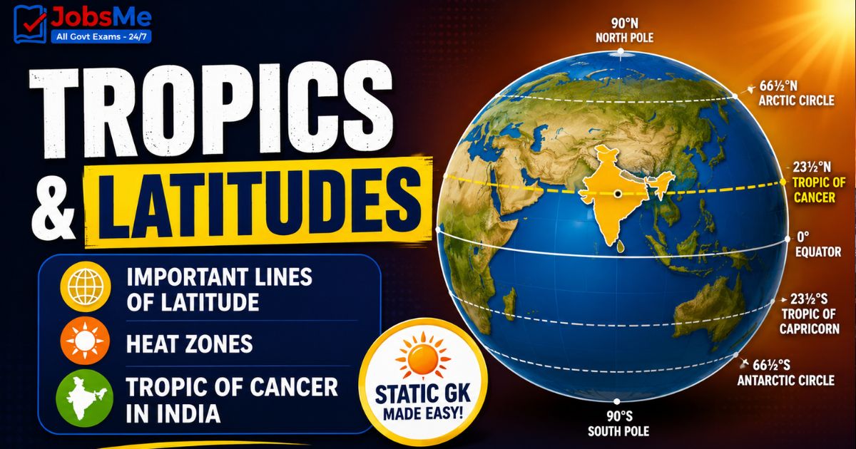
Tropics & Latitudes Static GK: Important Lines of Latitude, Heat Zones & Tropic of Cancer in India
This article covers the five major lines of latitude — the Equator, Tropic of Cancer, Tropic of Capricorn, Arctic Circle, and Antarctic Circle — along with the Earth's heat zones and the Tropic of Cancer's path through India. It is a complete Static GK resource for SSC, IBPS, RRB, UPSC, and State PCS aspirants, packed with exam one-liners, mnemonics, and frequently asked facts.
Jump to section
Introduction to Tropics and Latitudes
Tropics & Latitudes is one of the most reliable scoring areas in the Static GK and General Awareness sections of almost every competitive exam. Whether you are preparing for SSC GK, IBPS, Railways GK, Insurance GK, or UPSC Prelims, questions on the Equator, the Tropic of Cancer, the Tropic of Capricorn, and the polar circles appear year after year. These imaginary lines drawn across the globe help us locate places, understand climate, and explain why some regions are hot while others stay frozen.
Latitudes are imaginary lines that run parallel to the Equator, measuring the distance of any place north or south of the Equator in degrees. There are five major lines of latitude that every exam aspirant must memorise, because they form the backbone of physical geography. A single clear understanding of these lines can help you solve multiple questions across geography, environment, and even current affairs.
In this Static GK guide, we have organised every important fact into clean tables, memory tricks, and quick one-liners so that revision becomes fast and stress-free. For daily practice on similar topics, you can bookmark our regularly updated Static GK notes section.
Core Concept: Understanding Latitudes
To master this topic, you first need to understand a few basic terms. These definitions are simple but extremely important for objective-type questions in government exams.
- Latitude: An imaginary line running parallel to the Equator. It measures how far north or south a place is, expressed in degrees (from 0° at the Equator to 90° at the poles).
- Parallels of Latitude: All the latitude circles drawn from the Equator up to the poles are called parallels of latitude because they are parallel to each other.
- Equator: The 0° latitude line that divides the Earth into the Northern Hemisphere and the Southern Hemisphere. It is the longest latitude.
- Axial Tilt: The Earth is tilted at about 23.5° on its axis. This tilt is the reason the Tropics and polar circles exist where they do.
- Solstice: The day when the Sun is directly overhead at a tropic. The Sun is overhead at the Tropic of Cancer on the June Solstice (around 21 June) and at the Tropic of Capricorn on the December Solstice (around 21 December).
The Five Major Lines of Latitude
There are five major lines of latitude that circle the Earth. They are listed below from north to south, along with their exact position and key features. Every value in this table is a frequently tested exam fact.
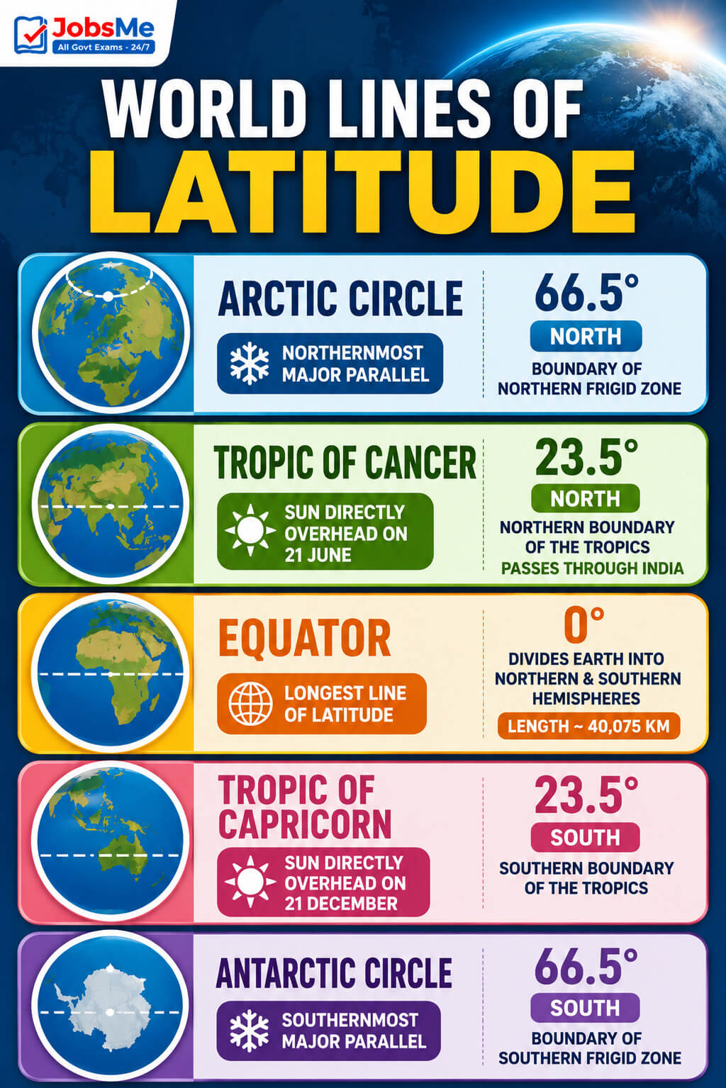
World Lines of Latitude
| Line of Latitude | Position (Degrees) | Key Features / Description |
|---|---|---|
| Arctic Circle | 66.5° North | The northernmost major parallel. North of this line, the Sun stays above the horizon for at least one full 24-hour day in summer and stays below the horizon for at least one full day in winter. It marks the boundary of the northern frigid zone. |
| Tropic of Cancer | 23.5° North | The northernmost point where the Sun is directly overhead at noon, which happens on the June Solstice (around 21 June). It forms the northern boundary of the tropics and passes through India. |
| Equator | 0° | The longest line of latitude. It divides the Earth into the Northern and Southern Hemispheres and has a length of roughly 40,075 km. The Sun is overhead here on the two equinoxes. |
| Tropic of Capricorn | 23.5° South | The southernmost point where the Sun is directly overhead at noon, which happens on the December Solstice (around 21 December). It forms the southern boundary of the tropics. |
| Antarctic Circle | 66.5° South | The southernmost major parallel. South of this line, the Sun stays above the horizon for at least one full day in summer and below it for at least one full day in winter. It marks the boundary of the southern frigid zone. |
Apart from these five, the North Pole (90° N) and South Pole (90° S) mark the extreme ends of latitude.
Heat Zones of the Earth
The major lines of latitude divide the Earth into three heat zones based on how much direct sunlight each region receives. This is a classic exam topic.
| Heat Zone | Location | Key Features / Description |
|---|---|---|
| Torrid Zone | Tropic of Cancer (23.5° N) to Tropic of Capricorn (23.5° S) | The hottest zone. The Sun is directly overhead at least once a year, so it receives the maximum heat. Also called the tropical zone. |
| Temperate Zone | Tropic of Cancer to Arctic Circle (North) and Tropic of Capricorn to Antarctic Circle (South) | A moderate-climate zone. The Sun's rays are slanting, so the heat keeps decreasing as you move toward the poles. There are two temperate zones, one in each hemisphere. |
| Frigid Zone | Arctic Circle to North Pole and Antarctic Circle to South Pole | The coldest zone. The Sun's rays are always very slanting, providing very little heat. There are two frigid zones, one in each hemisphere. |
India-Specific: Tropic of Cancer
The Tropic of Cancer is the most important latitude for Indian geography because it passes through the middle of the country, dividing India into almost two halves. The following India-specific facts are extremely high-yield for SSC, Railways, and State PCS exams.
| Fact | Detail / Description |
|---|---|
| States it passes through | The Tropic of Cancer passes through 8 Indian states: Gujarat, Rajasthan, Madhya Pradesh, Chhattisgarh, Jharkhand, West Bengal, Tripura, and Mizoram. |
| Entry point into India | It enters India from the west through the Rann of Kutch region in Gujarat and exits towards Myanmar in the east through Mizoram. |
| Only capital on the line | Ranchi, the capital of Jharkhand, is the only state capital located almost on the Tropic of Cancer. |
| Capitals close to the line | Bhopal (Madhya Pradesh) and Gandhinagar (Gujarat) are located fairly close to the Tropic of Cancer. |
| River that cuts it twice | The Mahi River is the only river in India that crosses the Tropic of Cancer twice. |
| Global reach | Worldwide, the Tropic of Cancer passes through 16-17 countries, 3 continents, and 6 water bodies. |
Memory Tricks and Mnemonics
Use these tested memory tricks to lock in the facts permanently. They are designed for fast recall during the exam.
Trick 1: Order of the Five Lines (North to South)
Remember the lines from top to bottom using their starting letters: A - C - E - C - A (Arctic Circle, Cancer, Equator, Capricorn, Antarctic Circle).
"Aunty Came, Everyone Came Again" — A symmetrical, easy-to-recall pattern.
Trick 2: The Symmetry Trick (23.5 and 66.5)
The two Tropics sit at 23.5° and the two polar circles at 66.5°. Notice that 23.5 + 66.5 = 90 (the pole). Remembering one automatically gives you the other.
Trick 3: Cancer = Up, Capricorn = Down
"CaNcer is North, CaPricorn is south." Cancer has an "N" sound leaning towards North; Capricorn points down to the South. This avoids the most common mix-up in exams.
Trick 4: 8 States of the Tropic of Cancer (West to East)
Use the sentence: "Gujarat Rajwadi Maharaja Chala Jhatpat West Tripura Mizoram" for Gujarat, Rajasthan, Madhya Pradesh, Chhattisgarh, Jharkhand, West Bengal, Tripura, Mizoram.
- A shorter acronym: "GR-MC-J-W-T-M".
Trick 5: Solstice Dates (June vs December)
"Cancer in June, Capricorn in December." The Sun is overhead the Tropic of Cancer on 21 June (Summer Solstice in the Northern Hemisphere) and the Tropic of Capricorn on 21 December (Winter Solstice in the Northern Hemisphere).
Trick 6: Heat Zones — "Torrid is Terribly hot"
"Torrid = Terribly hot, Temperate = Tolerable, Frigid = Freezing." The three Ts and one F make the order from the Equator outwards easy to remember.
Trick 7: Only Capital on the Line
"Ranchi Rests Right on it." Ranchi is the only Indian state capital sitting almost exactly on the Tropic of Cancer.
Additional Notes
Frequently Confused Facts
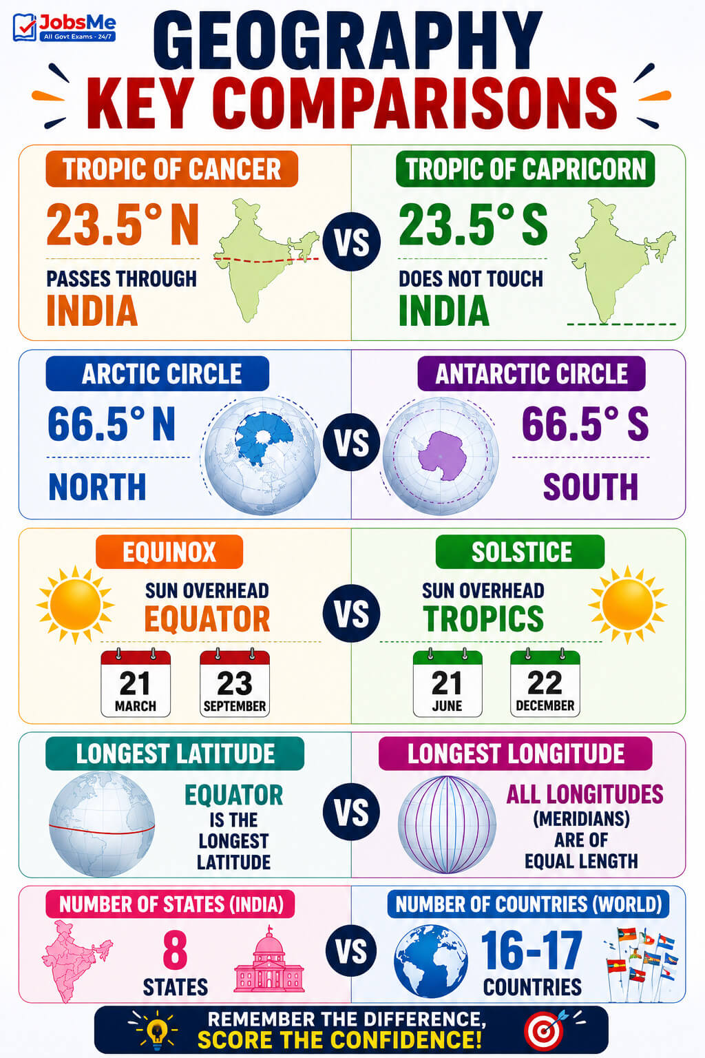
- Tropic of Cancer vs Tropic of Capricorn: Cancer is at 23.5° North; Capricorn is at 23.5° South. Cancer passes through India; Capricorn does not touch India at all.
- Arctic Circle vs Antarctic Circle: Both are at 66.5°, but Arctic is North and Antarctic is South.
- Equinox vs Solstice: The Sun is overhead the Equator on the equinoxes (around 21 March and 23 September), while it is overhead the Tropics on the solstices.
- Longest latitude vs longest longitude: The Equator is the longest latitude; all longitudes (meridians) are of equal length as they meet at the poles.
- Number of states (8) vs number of countries (16-17): The Tropic of Cancer passes through 8 Indian states but 16-17 countries worldwide.
Repeating PYQ Patterns
- SSC CGL / CHSL: Frequently asks the degree value of the Tropic of Cancer, the number of states it passes through, and the only capital on the line (Ranchi).
- RRB NTPC / Group D: Often tests the heat zones and which line forms the boundary of the tropics.
- IBPS / Insurance: Asks the latitude of the Equator and the difference between Cancer and Capricorn.
- UPSC Prelims / State PCS: Tests deeper facts like the Mahi River crossing the line twice and the entry of the Tropic through the Rann of Kutch.
Quick Insight
Understanding the Tropics is not just bookish — it explains real-world climate and current affairs. The region between the two Tropics holds nearly 40% of the world's surface and population, which is why tropical countries like India are central to global discussions on monsoons, heatwaves, and climate change. Knowing why the Sun is directly overhead at the Tropic of Cancer also helps you understand India's intense summers around June. Strengthen this base further with our Static GK posts and stay updated with daily current affairs.
One-Liners for Quick Revision
- Latitude → imaginary line parallel to the Equator → measured in degrees from 0° to 90°.
- Equator → 0° latitude → longest latitude, divides Earth into Northern and Southern Hemispheres (length ~40,075 km).
- Tropic of Cancer → 23.5° North → northern boundary of the tropics, Sun overhead on 21 June.
- Tropic of Capricorn → 23.5° South → southern boundary of the tropics, Sun overhead on 21 December.
- Arctic Circle → 66.5° North → boundary of the northern frigid zone, 24-hour day/night phenomenon.
- Antarctic Circle → 66.5° South → boundary of the southern frigid zone, 24-hour day/night phenomenon.
- North Pole → 90° North → northernmost point of the Earth.
- South Pole → 90° South → southernmost point of the Earth.
- Axial tilt of Earth → about 23.5° → the reason the Tropics and polar circles exist where they do.
- Torrid Zone → between the two Tropics → hottest zone, Sun overhead at least once a year.
- Temperate Zone → Tropic to polar circle in each hemisphere → moderate climate, slanting Sun rays.
- Frigid Zone → polar circle to pole in each hemisphere → coldest zone, very slanting rays.
- Tropic of Cancer in India → passes through 8 states → Gujarat, Rajasthan, Madhya Pradesh, Chhattisgarh, Jharkhand, West Bengal, Tripura, Mizoram.
- Entry of Tropic of Cancer → enters India through Gujarat (Rann of Kutch) → exits via Mizoram towards Myanmar.
- Ranchi → only Indian state capital on the Tropic of Cancer → capital of Jharkhand.
- Mahi River → only Indian river to cross the Tropic of Cancer twice.
- Tropic of Cancer (world) → passes through 16-17 countries, 3 continents, 6 water bodies.
- Solstice → Sun overhead a tropic → June Solstice for Cancer, December Solstice for Capricorn.
- Equinox → Sun overhead the Equator → around 21 March and 23 September.
Now that your concepts are clear, test yourself with our Static GK quizzes and revise related topics through daily current affairs quizzes. For the newest vacancies and exam alerts, keep checking our latest govt jobs notifications.
Free quiz • No signup required
Put this topic into practice with Indian Cultural Institutions – Static GK MCQ Quiz. It is the quickest way to reinforce what you just learned.
Frequently Asked Questions
How many major lines of latitude are there on Earth?
At what degree is the Tropic of Cancer located?
Through how many states in India does the Tropic of Cancer pass?
Which is the only Indian state capital located on the Tropic of Cancer?
Which Indian river crosses the Tropic of Cancer twice?
Why is the Equator considered the most important latitude?
What are the three heat zones of the Earth?
On which dates is the Sun directly overhead the Tropics?
What is the position of the Arctic and Antarctic Circles?
Why do the Tropics exist at 23.5 degrees?

About the author