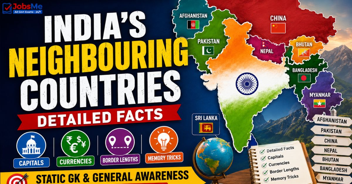
India's Neighbouring Countries – Detailed Facts, Capitals, Currencies & Border Lengths | Static GK & General Awareness for Competitive Exams with Memory Tricks
This article presents complete and detailed facts about India's neighbouring countries, covering all seven land neighbours (Pakistan, China, Nepal, Bhutan, Bangladesh, Myanmar, Afghanistan) and two maritime neighbours (Sri Lanka and the Maldives), along with their capitals, currencies, official languages, shared border lengths, bordering Indian states, boundary lines, and border-guarding forces. It also covers the famous boundary lines like the Radcliffe Line, McMahon Line, Durand Line, LoC, and LAC, with memory tricks and one-liners for quick revision. All facts are arranged in exam-ready format to help UPSC, SSC, IBPS, RRB, PSU, and State PCS aspirants score better in General Awareness and Geography sections.
Jump to section
- Introduction
- Core Concepts: Understanding India's Borders
- India's Neighbouring Countries - Capitals, Currencies and Border Lengths
- Bordering Indian States of Each Neighbour
- Important Boundary Lines of India
- Border-Guarding Forces of India
- Memory Tricks and Mnemonics
- Additional Notes
- One-Liners for Quick Revision
Introduction
India, the seventh-largest country in the world by land area, occupies a central position in South Asia and shares its borders with nine neighbouring countries. Of these, seven countries share land borders with India — Pakistan, China, Nepal, Bhutan, Bangladesh, Myanmar, and Afghanistan — while two countries share only maritime borders — Sri Lanka and the Maldives. India's total land boundary measures approximately 15,106.7 km, and it passes through 17 states and union territories.
Questions on India's neighbouring countries appear regularly in UPSC Prelims, SSC CGL, IBPS PO, RRB NTPC, SBI Clerk, State PCS, and various Insurance and Defence exams. Questions typically ask which country shares the longest or shortest border with India, the capital and currency of a neighbour, which Indian states touch a particular border, or which boundary line separates India from a specific country. This article brings together every important fact in a structured, exam-ready format. To explore other related Static GK topics, you can refer to the Static GK section on thejobsme.com.
The topic is also closely tied to current affairs themes such as India's "Neighbourhood First" policy, the SAGAR (Security and Growth for All in the Region) vision, cross-border trade agreements, water-sharing treaties, and periodic border tensions along the LoC and LAC — making it doubly important for aspirants preparing for UPSC Mains and General Awareness sections of banking and railway exams. For daily updates on such themes, aspirants can follow the Daily Current Affairs page.
Core Concepts: Understanding India's Borders
India's borders are a mix of settled international boundaries, disputed-but-claimed lines, and undemarcated de facto lines. Understanding the difference between them, along with the direction in which each neighbour lies, helps students answer both matching and map-based questions confidently.
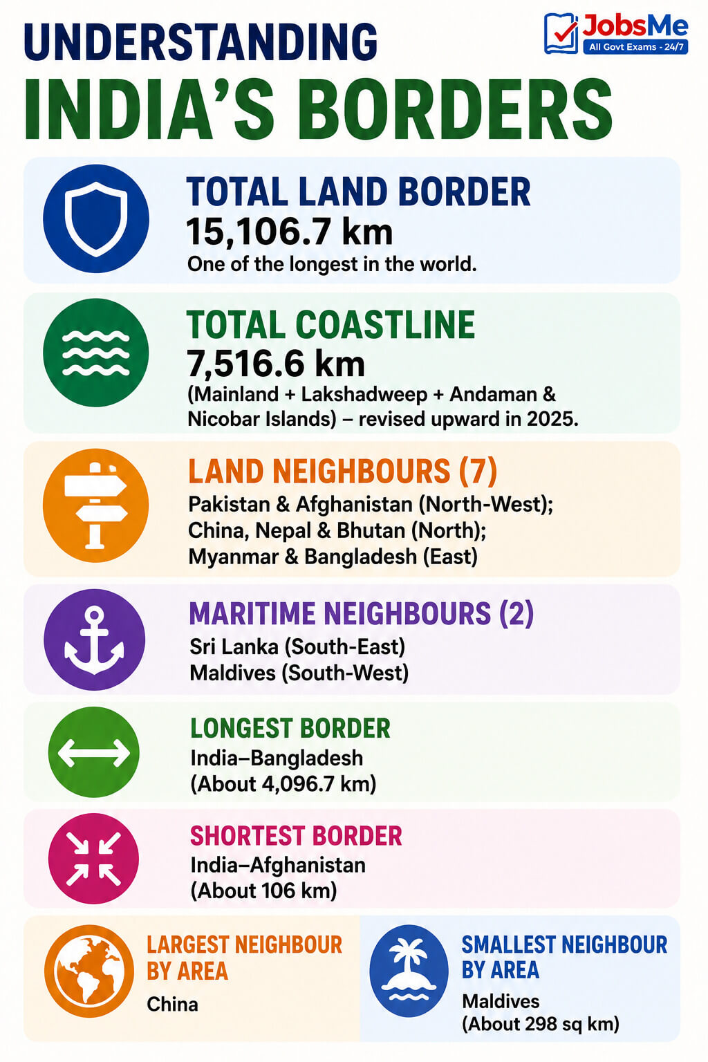
Key Facts to Remember
- Total land border: approximately 15,106.7 km, one of the longest in the world.
- Total coastline: traditionally quoted as 7,516.6 km (mainland plus Lakshadweep and Andaman & Nicobar Islands); this figure was revised upward by the government in 2025.
- Land neighbours (7): Pakistan and Afghanistan to the north-west; China, Nepal, and Bhutan to the north; Myanmar and Bangladesh to the east.
- Maritime neighbours (2): Sri Lanka to the south-east (across the Palk Strait and Gulf of Mannar) and the Maldives to the south-west (across the Lakshadweep Sea).
- Longest border: India-Bangladesh (about 4,096.7 km).
- Shortest border: India-Afghanistan (about 106 km, via Pakistan-occupied Kashmir / Ladakh region).
- Largest neighbour by area: China.
- Smallest neighbour by area: the Maldives (about 298 sq km).
India's Neighbouring Countries - Capitals, Currencies and Border Lengths
The following table lists all nine neighbouring countries of India along with their capitals, currencies, official languages, shared border length, and key details frequently asked in competitive exams.
| Country | Capital | Currency | Border Length & Type | Key Details |
|---|---|---|---|---|
| Bangladesh | Dhaka | Bangladeshi Taka | About 4,096.7 km (Land - Longest) | Official language Bengali; lies to the east; was formerly East Pakistan and gained independence in the 1971 Liberation War with India's support; border decided by the Radcliffe Line and guarded by the BSF. |
| China | Beijing | Chinese Yuan (Renminbi) | About 3,488 km (Land) | Official language Mandarin; India's largest neighbour by area (about 9.6 million sq km); relations governed by the Panchsheel Agreement of 1954; Aksai Chin and Arunachal Pradesh remain disputed; border is the McMahon Line (eastern sector) and the de facto Line of Actual Control (LAC). |
| Pakistan | Islamabad | Pakistani Rupee | About 3,323 km (Land) | Lies to the north-west; created from undivided British India in 1947; the international boundary is the Radcliffe Line and the military line in Jammu & Kashmir is the Line of Control (LoC); famous Wagah-Attari border ceremony near Amritsar; guarded by the BSF. |
| Nepal | Kathmandu | Nepalese Rupee | About 1,751 km (Land) | Official language Nepali; a landlocked Himalayan country to the north; home to Mount Everest, the world's highest peak; open and porous border considered one of the friendliest; guarded by the SSB. |
| Myanmar | Naypyidaw | Burmese Kyat | About 1,643 km (Land) | Also known as Burma; official language Burmese; lies to the east; a key partner in India's "Act East Policy"; border trade through the Moreh-Tamu crossing; guarded by the Assam Rifles. |
| Bhutan | Thimphu | Bhutanese Ngultrum | About 699 km (Land) | Official language Dzongkha; a landlocked Himalayan kingdom to the north-east; India assists in its defence and hydropower development; relations marked by deep trust; guarded by the SSB. |
| Afghanistan | Kabul | Afghan Afghani | About 106 km (Land - Shortest) | Border lies in the Ladakh region via Pakistan-occupied Kashmir (PoK); the boundary is the Durand Line (drawn by Sir Mortimer Durand); historically linked to India through the Silk Route; India is a major development partner. |
| Sri Lanka | Sri Jayawardenepura Kotte (legislative); Colombo (commercial) | Sri Lankan Rupee | Maritime Border | Island nation to the south-east; separated from India by the Palk Strait and the Gulf of Mannar; the shortest distance is about 30 km via Adam's Bridge (Ram Setu); deep cultural links through Buddhism and the Tamil population. |
| Maldives | Male | Maldivian Rufiyaa | Maritime Border | Smallest neighbour (about 298 sq km); official language Dhivehi; a chain of over a thousand coral islands to the south-west, across the Lakshadweep Sea; a key partner in India's "Neighbourhood First" and SAGAR policies. |
Bordering Indian States of Each Neighbour
A very common exam question is which Indian states or union territories touch the border of a particular neighbouring country. The following table lists the bordering states for each land neighbour.
| Neighbouring Country | Bordering Indian States / UTs | Number of States / UTs |
|---|---|---|
| Pakistan | Ladakh (UT), Jammu & Kashmir (UT), Punjab, Rajasthan, Gujarat | 5 (including 2 UTs) |
| China | Ladakh (UT), Himachal Pradesh, Uttarakhand, Sikkim, Arunachal Pradesh | 5 (including 1 UT) |
| Nepal | Uttarakhand, Uttar Pradesh, Bihar, West Bengal, Sikkim | 5 |
| Bhutan | Sikkim, West Bengal, Assam, Arunachal Pradesh | 4 |
| Bangladesh | West Bengal, Assam, Meghalaya, Tripura, Mizoram | 5 |
| Myanmar | Arunachal Pradesh, Nagaland, Manipur, Mizoram | 4 |
| Afghanistan | Ladakh (UT) - via Pakistan-occupied Kashmir (PoK) | 1 (UT, disputed) |
Important Boundary Lines of India
Several of India's borders carry historical names. Distinguishing a settled international boundary from a disputed line or a de facto control line is a frequently tested concept. Refer to the Static GK notes on thejobsme.com for related topics.
| Boundary Line | Between | Key Details |
|---|---|---|
| Radcliffe Line | India and Pakistan (and India and Bangladesh) | Drawn by British lawyer Sir Cyril Radcliffe and published in August 1947 after Partition; divided the provinces of Punjab and Bengal; remains the legally settled international boundary on the western (Pakistan) and eastern (Bangladesh) fronts. |
| McMahon Line | India and China (Eastern Sector) | Proposed by Sir Henry McMahon at the Shimla Convention of 1914; runs along the Himalayan crest in present-day Arunachal Pradesh; India treats it as the boundary, but China does not accept it. |
| Line of Actual Control (LAC) | India and China | The de facto, undemarcated line separating Indian-controlled and Chinese-controlled territory across the western, middle, and eastern sectors; not a legally recognised international boundary. |
| Line of Control (LoC) | India and Pakistan (Jammu & Kashmir) | Originally the Ceasefire Line after the 1949 Karachi Agreement; renamed the Line of Control after the Simla Agreement of 1972; a military-controlled line, not a legally recognised international boundary. |
| Durand Line | Afghanistan and Pakistan | Drawn by Sir Mortimer Durand in 1893 (demarcation completed by 1896); today it is the Afghanistan-Pakistan boundary, tested in exams because it once marked the limit of British India; India's link is only via PoK. |
Border-Guarding Forces of India
India follows a broad "one border, one force" approach, with a dedicated central armed police force responsible for each border. This is a high-frequency topic in Defence, SSC, and Police recruitment exams.
| Border | Guarding Force | Key Details |
|---|---|---|
| India-Pakistan and India-Bangladesh | Border Security Force (BSF) | Raised in 1965 after the Indo-Pak War exposed the inadequacy of state police forces; India's largest border-guarding force. |
| India-China (LAC) | Indo-Tibetan Border Police (ITBP) | Raised in 1962 after the Sino-Indian War; specialises in high-altitude border patrolling. |
| India-Nepal and India-Bhutan | Sashastra Seema Bal (SSB) | Raised in 1963; guards the open and friendly Himalayan borders with Nepal and Bhutan. |
| India-Myanmar | Assam Rifles (AR) | Oldest paramilitary force in India (raised in 1835); the only force with dual control — administrative under the MHA and operational under the Indian Army. |
| LoC and LAC (conflict zones) | Indian Army | Handles the sensitive military-controlled sectors along the Line of Control and the Line of Actual Control. |
Memory Tricks and Mnemonics
Trick 1: Seven Land Neighbours — "BB CMP AN"
Use this acronym to remember all seven land neighbours of India:
- B → Bangladesh.
- B → Bhutan.
- C → China.
- M → Myanmar.
- P → Pakistan.
- A → Afghanistan.
- N → Nepal.
"Big Brothers Come Making Peace Around Neighbours."
Trick 2: Border Length Order — "Bangladesh Beats China, Pakistan Next"
To remember land border lengths from longest to shortest:
- Bangladesh (4,096.7 km) > China (3,488 km) > Pakistan (3,323 km) > Nepal (1,751 km) > Myanmar (1,643 km) > Bhutan (699 km) > Afghanistan (106 km).
"Ba-Chi-Pa-Ne-My-Bhu-Af — long to short."
Trick 3: Boundary Lines — "Really Mad Dogs Love Land"
Match each boundary line to the pair of countries it separates:
- R → Radcliffe Line → India and Pakistan / Bangladesh.
- M → McMahon Line → India and China.
- D → Durand Line → Afghanistan and Pakistan.
- L → LoC (Line of Control) → India and Pakistan (J&K).
- L → LAC (Line of Actual Control) → India and China.
Trick 4: Border Forces — "BB-ITBP-SSB-AR"
Link each border force to its border:
- BSF → Pakistan and Bangladesh (the two "B/P" borders).
- ITBP → China (Tibet in the name gives it away).
- SSB → Nepal and Bhutan (the two friendly Himalayan kingdoms).
- Assam Rifles → Myanmar (Assam is next to the north-east / Myanmar border).
"ITBP for Tibet, Assam Rifles for the east."
Trick 5: Landlocked Himalayan Neighbours — "Nepal & Bhutan"
Only two neighbours are landlocked Himalayan countries to the north:
- Nepal → home to Mount Everest → capital Kathmandu.
- Bhutan → the "Land of the Thunder Dragon" → capital Thimphu.
"Two mountain kingdoms, no coastline."
Trick 6: Maritime Neighbours — "Sri Lanka South-East, Maldives South-West"
- Sri Lanka → south-east → separated by the Palk Strait and Gulf of Mannar (Ram Setu).
- Maldives → south-west → separated by the Lakshadweep Sea.
"Lanka on the East, Maldives on the West."
Trick 7: Longest and Shortest — "Big Bangladesh, Tiny Afghanistan"

- Longest land border → Bangladesh (4,096.7 km).
- Shortest land border → Afghanistan (106 km, via PoK).
- Largest neighbour by area → China.
- Smallest neighbour by area → Maldives (298 sq km).
Additional Notes
Frequently Confused Facts
- Longest border — Bangladesh, not Pakistan: India's longest land border is with Bangladesh (about 4,096.7 km), not Pakistan. This is one of the most common trap questions.
- McMahon Line vs LAC: The McMahon Line applies only to the eastern sector (Arunachal Pradesh) between India and China, whereas the LAC is the undemarcated de facto line across all sectors. They are not the same.
- Durand Line: It separates Afghanistan and Pakistan, not India and Afghanistan directly. India's link to Afghanistan is only via Pakistan-occupied Kashmir.
- LoC vs International Boundary: The Line of Control in Jammu & Kashmir is a military-controlled line (renamed from the Ceasefire Line under the 1972 Simla Agreement), not a legally recognised international boundary.
- Sri Lanka's capital: The legislative capital is Sri Jayawardenepura Kotte, while Colombo is the commercial capital — a frequent point of confusion.
- Myanmar's capital: The capital is Naypyidaw, not Yangon (the former capital).
- Bhutan currency vs Nepal currency: Bhutan uses the Ngultrum, while Nepal uses the Nepalese Rupee — do not mix them up.
- Palk Strait vs Lakshadweep Sea: Sri Lanka is separated from India by the Palk Strait and Gulf of Mannar; the Maldives is separated by the Lakshadweep Sea.
Repeating PYQ Patterns
Certain facts are asked repeatedly in competitive exams. The longest border (Bangladesh), the shortest border (Afghanistan), the boundary lines (Radcliffe, McMahon, Durand), the difference between LoC and LAC, capitals and currencies of neighbours, and the border-guarding forces (BSF, ITBP, SSB, Assam Rifles) appear most often in UPSC Prelims, SSC CGL, and RRB NTPC papers. Banking exams (IBPS PO, SBI Clerk) frequently test capitals and currencies of neighbouring countries in the General Awareness section. Defence and Police exams focus heavily on the border-guarding forces and their years of establishment. State PCS exams add regional angles — West Bengal PCS on the Petrapole-Benapole crossing with Bangladesh, Punjab PCS on the Wagah-Attari ceremony, and Manipur/Nagaland PCS on the Moreh-Tamu crossing with Myanmar.
Quick Insight
India's neighbourhood is central to its foreign policy, expressed through the "Neighbourhood First" policy and the maritime SAGAR vision. Each border tells a story — the Radcliffe Line recalls the trauma of Partition; the McMahon Line and LAC recall the unresolved Sino-Indian boundary; and the friendly, open Indo-Nepal border reflects centuries of shared culture. Understanding these facts helps aspirants connect any geopolitical reference to its geographical basis, which is invaluable for both Prelims (direct matching questions) and Mains (essays and answers on border management, regional cooperation, and internal security). For further reading, you can refer to the Static GK notes and stay updated with the Daily Current Affairs page on thejobsme.com.
One-Liners for Quick Revision
- India's land neighbours (7) → Pakistan, China, Nepal, Bhutan, Bangladesh, Myanmar, Afghanistan.
- India's maritime neighbours (2) → Sri Lanka and the Maldives.
- Total neighbours → 9 countries.
- Total land boundary → about 15,106.7 km.
- Total coastline → traditionally 7,516.6 km (revised upward in 2025).
- Longest land border → Bangladesh (about 4,096.7 km).
- Shortest land border → Afghanistan (about 106 km, via PoK).
- Largest neighbour by area → China.
- Smallest neighbour by area → Maldives (about 298 sq km).
- Bangladesh → Capital Dhaka → Currency Bangladeshi Taka → Border via Radcliffe Line → guarded by BSF.
- China → Capital Beijing → Currency Chinese Yuan → Border via McMahon Line and LAC → guarded by ITBP.
- Pakistan → Capital Islamabad → Currency Pakistani Rupee → Border via Radcliffe Line and LoC → guarded by BSF.
- Nepal → Capital Kathmandu → Currency Nepalese Rupee → home to Mount Everest → guarded by SSB.
- Myanmar → Capital Naypyidaw → Currency Burmese Kyat → also called Burma → guarded by Assam Rifles.
- Bhutan → Capital Thimphu → Currency Bhutanese Ngultrum → Language Dzongkha → guarded by SSB.
- Afghanistan → Capital Kabul → Currency Afghan Afghani → Border via Durand Line (India link only through PoK).
- Sri Lanka → Capitals Sri Jayawardenepura Kotte (legislative) and Colombo (commercial) → Currency Sri Lankan Rupee → separated by Palk Strait and Gulf of Mannar.
- Maldives → Capital Male → Currency Maldivian Rufiyaa → Language Dhivehi → separated by the Lakshadweep Sea.
- Radcliffe Line → India-Pakistan and India-Bangladesh → drawn by Sir Cyril Radcliffe (1947).
- McMahon Line → India-China (eastern sector) → proposed at the Shimla Convention (1914); not accepted by China.
- Durand Line → Afghanistan-Pakistan → drawn by Sir Mortimer Durand (1893).
- Line of Control (LoC) → India-Pakistan in J&K → renamed from Ceasefire Line under the Simla Agreement (1972).
- Line of Actual Control (LAC) → India-China → undemarcated de facto line.
- BSF → guards Pakistan and Bangladesh borders → raised in 1965.
- ITBP → guards the China border (LAC) → raised in 1962.
- SSB → guards Nepal and Bhutan borders → raised in 1963.
- Assam Rifles → guards the Myanmar border → oldest paramilitary force (1835).
- Wagah-Attari → famous border ceremony on the India-Pakistan border near Amritsar.
- Moreh-Tamu → key border trade crossing on the India-Myanmar border.
- Adam's Bridge (Ram Setu) → about 30 km chain of shoals between India and Sri Lanka.
For more Static GK topics like boundary lines, Indian rivers, and geography one-liners, explore the Static GK section on thejobsme.com. You can also test your knowledge with the Static GK Quiz, follow the Daily Current Affairs Quiz, and check out the latest exam updates at Latest Government Job Notifications.
Free quiz • No signup required
Put this topic into practice with Indian Cultural Institutions – Static GK MCQ Quiz. It is the quickest way to reinforce what you just learned.
Frequently Asked Questions
How many neighbouring countries does India have?
Which country shares the longest land border with India?
Which country shares the shortest land border with India?
Which boundary line separates India and Pakistan?
What is the difference between the LoC and the LAC?
Which line is the boundary between India and China?
Which forces guard India's different borders?
Which are India's two maritime neighbours?
What are the capitals of India's neighbouring countries?
Which Indian states share a border with Bangladesh?

About the author